 Catalogues des Parcs Nationaux
Géologie
Type of resources
Available actions
INSPIRE themes
Provided by
Years
Formats
Representation types
Update frequencies
status
Service types
Scale
-
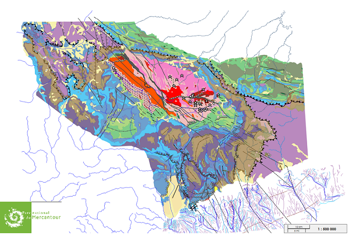
Différentes couches représentant différentes roches et structures géologiques, présentes à l'affleurement ou en sous-sol proche, de la région de l'aire du bien Unesco.
-
Couche représentant les principaux attributs géologiques qui composent l’ensemble Alpes de la Méditerranée.
-
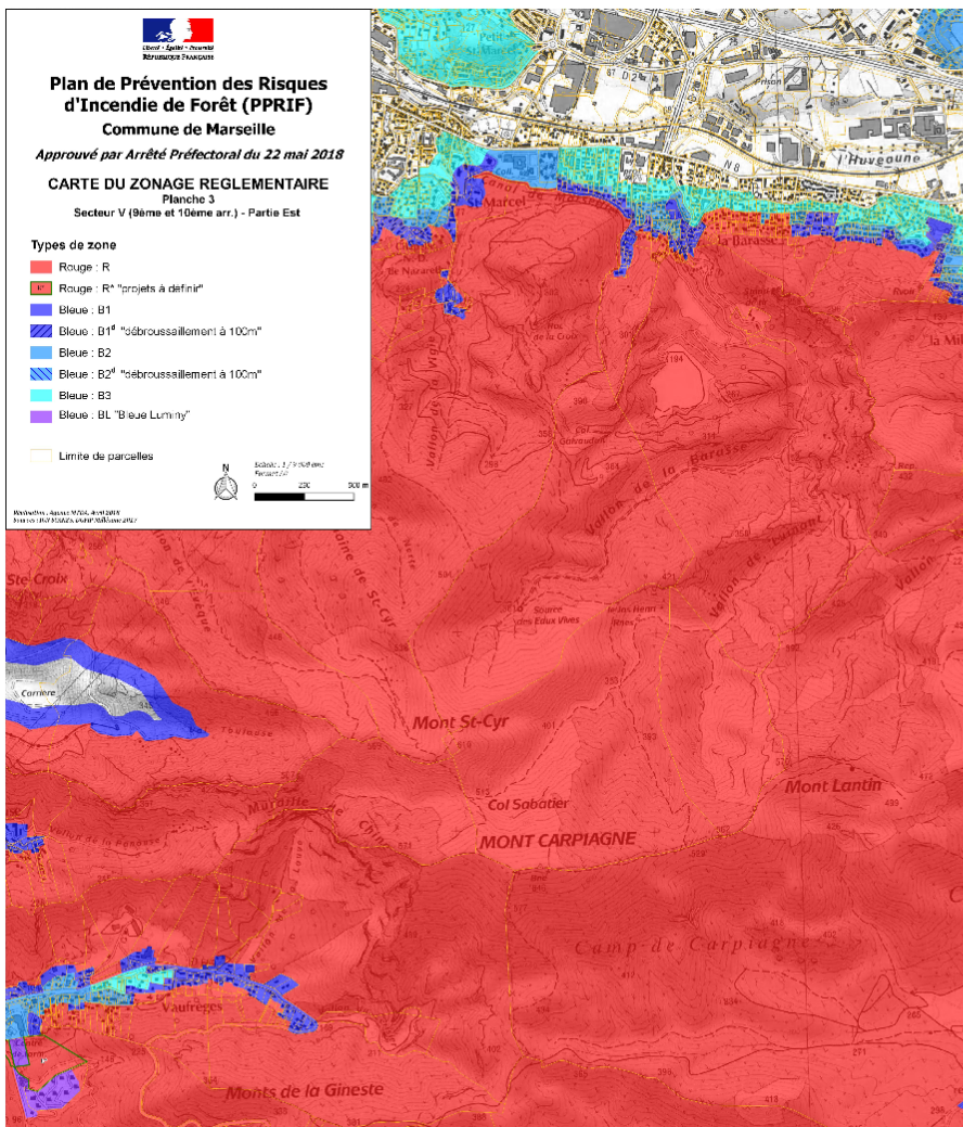
Plans PDF des différents plans de prévention de risques naturels (inondation - PPRi, incendie de forêt - PPRIF, mouvement de terrain, retrait et gonflement d'argile) sur les communes de Marseille, Cassis et la Ciotat édités par la DDTM 13. Les données SIG peuvent être demandées au besoin directement auprès de la DDTM ou sur le catalogue interministériel des données géographiques (www.catalogue.geo-ide.developpement-durable.gouv.fr).
-
Cette couche représente le découpage du littoral en unités morphosédimentaires en métropole et sur quatre territoires d'outre-mer (Guadeloupe, Martinique, Guyane et Mayotte). Ces unités morphosédimentaires ont été définies dans le cadre du projet "Dynamiques et évolution du littoral : synthèse des connaissances des côtes françaises". Les unités morphosédimentaires reposent sur un découpage du littoral en homogénéité de forme, nature et exposition de la côte.
-
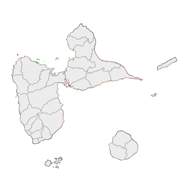
Cette couche représente la géomorphologie et la géologie du trait de côte reportée sur le trait de côte Histolitt (Trait de Côte Histolitt France métropolitaine V2 © IGN-SHOM 2009) à grande échelle. La source des données provient principalement du projet européen EUROSION et de photo-interprétations réalisées par le Cerema.
-
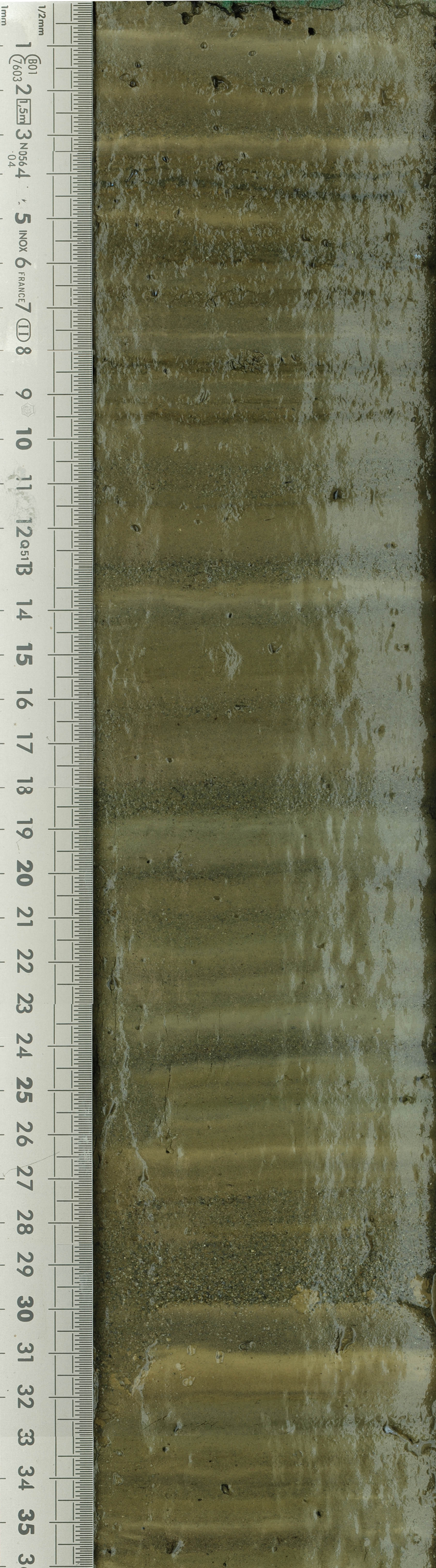
Local glacial fluctuations and flood occurrences were investigated in the sediment sequence of proglacial Lake Muzelle. The sample covers the period from 303 to 2012. X-ray fluorescence spectrometry (XRF) 2017 Based on geochemical analysis and organic matter content established using loss on ignition and reflectance spectroscopy, we identified six periods of increased glacial activity over the last 1700 yr. Each is in accordance with records from reference glaciers in the Alps. A total of 255 graded layers were identified and interpreted as flood deposits. Most of these occurred during glacial advances such as the Little Ice Age period and exhibit thicker deposits characterized by an increase in the fine grain-size fraction. Fine sediment produced by glacial activity is transported to the proglacial lake during heavy rainfall events. The excess of glacial flour during these periods seems to increase the watershed's tendency to produce flood deposits in the lake sediment, suggesting a strong influence of the glacier on flood reconstruction records. Thus, both flood frequency and intensity, which is estimated based on layer thickness as a proxy, cannot be used in reconstruction of past extreme events because of their variability. There is a need to take into account changes in sediment supply in proglacial areas that could preclude satisfactory interpretation of floods in terms of past climate variability. Roman era to contemporary era Glacial fluctuation Glacial focal spot LTER - ZA - RZA Zone Atelier Alpes ZAA
-

Local glacial fluctuations and flood occurrences were investigated in the sediment sequence of proglacial Lake Muzelle - Ecrins National Park - Composite sediment sequence Muz12-I - april 2012 - (IGSN:IEFRA00A4). The sample covers the period from 303 to 2012. Based on geochemical analysis and organic matter content established using loss on ignition and reflectance spectroscopy, we identified six periods of increased glacial activity over the last 1700 yr. Each is in accordance with records from reference glaciers in the Alps. A total of 255 graded layers were identified and interpreted as flood deposits. Most of these occurred during glacial advances such as the Little Ice Age period and exhibit thicker deposits characterized by an increase in the fine grain-size fraction. Fine sediment produced by glacial activity is transported to the proglacial lake during heavy rainfall events. The excess of glacial flour during these periods seems to increase the watershed's tendency to produce flood deposits in the lake sediment, suggesting a strong influence of the glacier on flood reconstruction records. Thus, both flood frequency and intensity, which is estimated based on layer thickness as a proxy, cannot be used in reconstruction of past extreme events because of their variability. There is a need to take into account changes in sediment supply in proglacial areas that could preclude satisfactory interpretation of floods in terms of past climate variability. LTER - ZA - RZA Zone Atelier Alpes ZAA
-
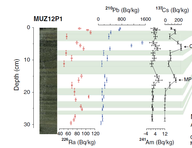
Local glacial fluctuations and flood occurrences were investigated in the sediment sequence of proglacial Lake Muzelle. Composite sediment sequence Muz12-I – april 2012 (IGSN:IEFRA00A4). The sample covers the period from 303 to 2012. Based on geochemical analysis and organic matter content established using loss on ignition and reflectance spectroscopy, we identified six periods of increased glacial activity over the last 1700 yr. Each is in accordance with records from reference glaciers in the Alps. A total of 255 graded layers were identified and interpreted as flood deposits. Most of these occurred during glacial advances such as the Little Ice Age period and exhibit thicker deposits characterized by an increase in the fine grain-size fraction. Fine sediment produced by glacial activity is transported to the proglacial lake during heavy rainfall events. The excess of glacial flour during these periods seems to increase the watershed's tendency to produce flood deposits in the lake sediment, suggesting a strong influence of the glacier on flood reconstruction records. Thus, both flood frequency and intensity, which are estimated based on layer thickness as a proxy, cannot be used in reconstruction of past extreme events because of their variability. There is a need to take into account changes in sediment supply in proglacial areas that could preclude satisfactory interpretation of floods in terms of past climate variability. Glacial fluctuation Glacial focal spot LTER - ZA - RZA Zone Atelier Alpes ZAA
-

Local glacial fluctuations and flood occurrences were investigated in the sediment sequence of proglacial Lake Muzelle - Ecrins national Park - Composite sequence Muz12-I - april 2012 (IGSN:IEFRA00A4). Field mission 04 october 2012 (Mission "THESE FOUINAT MUZELLE L10/04/2012"). Project "THESE 2 ALPES PN ECRINS". Head of mission Pierre Sabatier The sequence covers the period from year 303 to 2012. Roman era to contemporary era. Glacial fluctuation LTER - ZA - RZA Zone Atelier Alpes ZAA
-
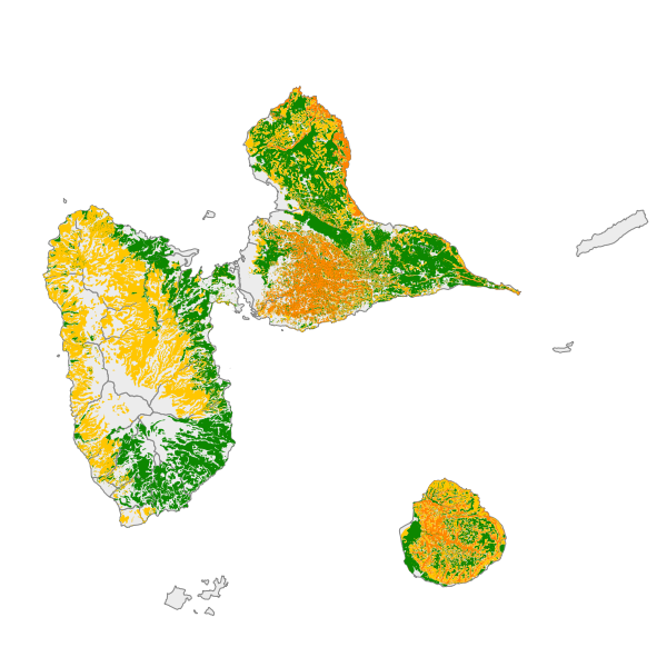
La valeur agronomique des sols mesure la fertilité intrinsèque des sols, c'est-à-dire leur aptitude naturelle à produire des rendements élevés. Concerne la Guadeloupe, Saint-Martin et Saint-Barthélemy.