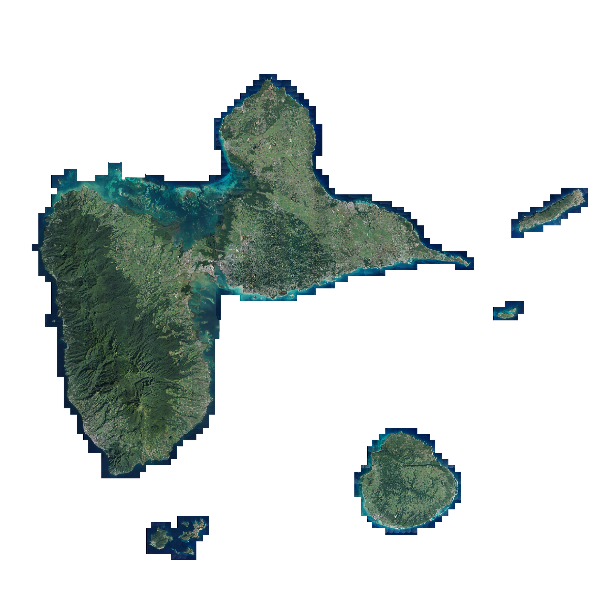
Orthophoto HR 2017
L'ORTHO HR® est une collection de mosaïques numériques d'orthophotographies en couleurs rectifiées en projection légale. La résolution est de 20 cm (ou moins). Les dalles font 1 km x 1km (ou moins s'il s'agit de très haute résolution).
Simple
- Alternate title
- ORTHOHR_1-0_JP2-E080_UTM20W84GUAD_D971-2017
- Date ( Revision )
- 2020-03-20T21:43:15
- Date ( Publication )
- 2018-03-14
- Edition
- 2017
- Edition date
- 2018-01-06
- Name
- IGNF_ORTHOHR_1-0.xml
- Issue identification
- Produit
- Purpose
- L'ORTHO HR® se compose d'images numériques (sans habillage ni surcharge) et d'indications de géoréférencement. Le produit est destiné à une exploitation numérique pour un usage technique. Il peut être utilisé pour un usage de communication à l'aide des fonctionnalités d'outils simples de manipulation d'image. Le contenu informationnel est compatible avec des échelles de travail de l'ordre du 1 :5,000ième ou plus petites, et peut permettre localement une utilisation jusqu'au 1 :2,000ième.
- Status
- On going
Custodian
Institut national de l'information géographique et forestière (IGN-F)
IGN - Service clients
,
73 avenue de Paris
,
SAINT-MANDE cedex
,
94165
,
FRANCE
- Maintenance and update frequency
- Irregular
- Maintenance note
- Tous les 5 ans
- GEMET - INSPIRE themes, version 1.0 ( Theme )
-
- Ortho-imagerie
- Keywords ( Theme )
-
- ortho-imagerie
- Keywords
-
- Use limitation
- Base de données soumise aux conditions générales d'utilisation des fichiers IGN
- Access constraints
- License
- Use constraints
- Other restrictions
- Other constraints
- Pas de restriction d'accès public selon INSPIRE
- Other constraints
- Open data
- Use limitation
- Aucune contrainte
- Classification
- Unclassified
- Spatial representation type
- Grid
- Distance
- 0.2 m
- Metadata language
- fr
- Character set
- 8859 Part 15
- Topic category
-
- Imagery base maps earth cover
- Description
- Ensemble de dalles image - Traitement : dpsg2018-03-00282
N
S
E
W
))
- Geographic identifier
-
http://xml.insee.fr/schema/cog.xsd#xpointer(//*[@name='Code_Région_stype']
)
/
01
/
2006
- Date ( Publication )
- 2005
- Geographic identifier
-
http://xml.insee.fr/schema/cog.xsd#xpointer(//*[@name='Code_Département_stype']
)
/
971
/
2006
- Date ( Publication )
- 2005
- Description
- Actualité de la prise de vue
- Begin date
- 2017-01-12
- End date
- 2017-02-12
- Unique resource identifier
- WGS84 UTM Nord fuseau 20
- Codespace
- urn:ogc:def:crs:IGNF:1.1
Spatial representation info
No information provided.
- Distribution format
-
-
JPEG 2000
(
ISO/CEI 15444-1
)
-
JPEG 2000
(
ISO/CEI 15444-1
)
Distributor
Distributor
Institut national de l'information géographique et forestière (IGN-F)
IGN - Service clients
,
73 avenue de Paris
,
SAINT-MANDE cedex
,
94165
,
FRANCE
- Fees
- Voir catalogue des prix IGN
- Ordering instructions
- Voir site internet www.ign.fr
- Units of distribution
- Extraction
- OnLine resource
- http://www.ign.fr/
- OnLine resource
- http://www.geoportail.fr/
- OnLine resource
- www.ign.fr ( HTTP )
- OnLine resource
- raster_Ortho_2017_tuillage_ortho_2017_shp ( OGC:WMS-1.1.1-http-get-map )
- OnLine resource
- https://catalogue.karugeo.fr/geosource/panierDownloadFrontalParametrage?LAYERIDTS=21418178 ( WWW:DOWNLOAD-1.0-http--download )
- OnLine resource
- Téléchargement direct des données ( WWW:LINK-1.0-http--link )
- Hierarchy level
- Series
- Hierarchy level
- Dataset
- Statement
- Produit par Institut national de l'information géographique et forestière (IGN-F)
Content Information
No information provided.
- File identifier
- fb19e070-5d83-4108-b646-fc3c3746c7c1 XML
- Metadata language
- fr
- Character set
- UTF8
- Hierarchy level
- Dataset
- Hierarchy level name
- Lot
- Date stamp
- 2020-03-30T15:37:58
- Metadata standard name
- ISO 19115
- Metadata standard version
- 2003 Cor.1:2006
Point of contact
Institut national de l'information géographique et forestière (IGN-F)
IGN - Service clients
,
73 avenue de Paris
,
SAINT-MANDE cedex
,
94165
,
FRANCE
Overviews

Aperçu
Spatial extent
N
S
E
W
))
Provided by

Associated resources
Not available
 Catalogues des Parcs Nationaux