 Catalogues des Parcs Nationaux
DAAF- CE BCAE et ZNT
Données CE BCAE et ZNT instruction DAAF
Simple
Identification info
- Date ( Revision )
- 2022-04-04T17:55:00
- Keywords ( Theme )
-
- Cours d'eau
- BCAE
- ZNT
- Keywords
-
- INSPIRE Service taxonomy ( Theme )
-
- infoMapAccessService
- Keywords
-
- Keywords
-
- Access constraints
- Other restrictions
- Use constraints
- License
- Other constraints
- Pas de restriction d’accès public selon INSPIRE
- Classification
- Unclassified
- Access constraints
- Other restrictions
- Other constraints
- Mentionner la source des données, le producteur et la date de création de la cartographie
- Service Type
- invoke
- Description
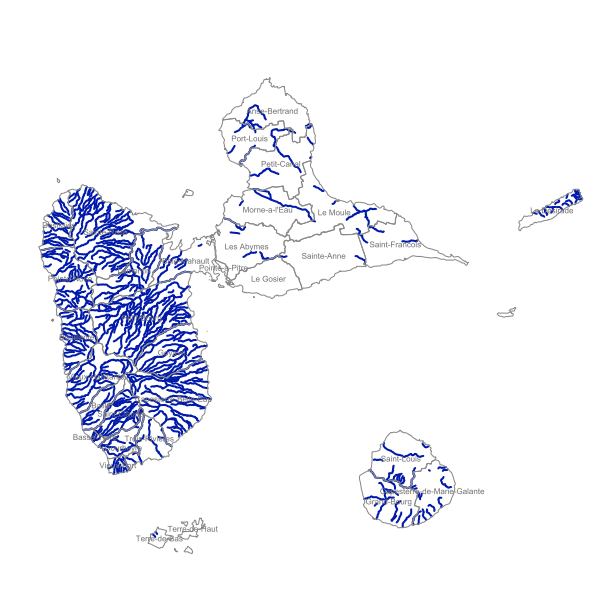
- Guadeloupe
N
S
E
W
))
- Coupling Type
- Tight
Contains Operations
- Operation Name
- Accès à la carte PDF
- Distributed Computing Platforms
- Web services
Contains Operations
- Operation Name
- Accès au fichier contexte OWS de la carte
- Distributed Computing Platforms
- Web services
Contains Operations
- Operation Name
- Accès à la carte interactive
- Distributed Computing Platforms
- Web services
Contains Operations
- Operation Name
- Accès au fichier contexte OWS de la carte
- Distributed Computing Platforms
- Web services
Contains Operations
- Operation Name
- Accès à la carte interactive
- Distributed Computing Platforms
- Web services
Contains Operations
- Operation Name
- Accès au fichier contexte OWS de la carte
- Distributed Computing Platforms
- Web services
Contains Operations
- Operation Name
- Accès à la carte interactive
- Distributed Computing Platforms
- Web services
Contains Operations
- Operation Name
- Accès au fichier contexte OWS de la carte
- Distributed Computing Platforms
- Web services
- Connect Point
- https://carto.karugeo.fr/context/getOws/21420125 ( WWW:LINK-1.0-http--link )
Contains Operations
- Operation Name
- Accès à la carte interactive
- Distributed Computing Platforms
- Web services
- Connect Point
- https://catalogue.karugeo.fr/geosource/consultation?id=21420125 ( WWW:LINK-1.0-http--link )
Coupled Resource
- Operation Name
- GetCapabilities
- Identifier
- 8d414463-5ed7-4629-9db5-277878b4b50f
Coupled Resource
- Operation Name
- GetCapabilities
- Identifier
- fac4ab0b-54d3-4d83-ae41-bab1c42c1a5f
- Operates On
- Reference system identifier
- EPSG / WGS 84 / UTM 20 / 7.4
- Reference system identifier
- EPSG / WGS 84 / UTM zone 20N (EPSG:32620) / 7.9
- Units of distribution
- liens associés
- OnLine resource
-
Accès à la carte
(
WWW:LINK-1.0-http--link
)
Accès à la carte
- OnLine resource
-
Accès au fichier contexte OWS de la carte
(
WWW:LINK-1.0-http--link
)
Accès au fichier contexte OWS de la carte
- OnLine resource
-
Accès au fichier PDF de la carte
(
WWW:LINK-1.0-http--link
)
Accès au fichier PDF de la carte
- Hierarchy level
- Service
- Statement
- Donnée traitée dans le cadre du CE BAEC En 2018, la structure du produit BD TOPO® change, ce qui engendre le passage à une version 3.0.
- File identifier
- 659a4c78-496d-4e1b-9fc6-810eac6181b4 XML
- Metadata language
- fre
- Character set
- UTF8
- Hierarchy level
- Service
- Hierarchy level name
- service
- Date stamp
- 2025-07-03T13:44:03
- Metadata standard name
- ISO 19115:2003/19139
- Metadata standard version
- 1.0
Overviews
Aperçu
Spatial extent
N
S
E
W
Provided by

Associated resources
Not available