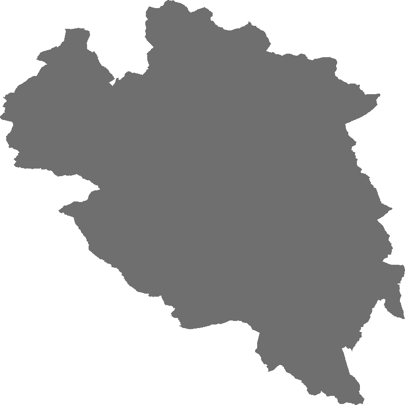
Aire optimale d'adhésion du Parc national des Ecrins
Limite de l'aire optimale d'adhésion du Parc national des Ecrins.
Couche générée par fusion des communes (IGN bd topo fev 2013).
Simple
- Date ( Creation )
- 2014-01-27T15:42:54
- Status
- Completed
Point of contact
00 33 4 92 40 20 30
Parc national des Ecrins
-MONCHICOURT Camille
(SIG
)Domaine de Charence
,Gap
,Provence-Alpes Côte d'Azur
,05000
,France
- Maintenance and update frequency
- As needed
- Keywords ( Theme )
-
-
Parc national
-
Aire optimale d'adhésion
-
Limites
-
- Keywords ( Place )
-
-
Parc national des Ecrins
-
- GEMET - INSPIRE themes, version 1.0 ( Theme )
-
-
Unités administratives
-
Resource constraints
- Access constraints
- Other restrictions
- Spatial representation type
- Vector
- Denominator
- 25000
- Character set
- UTF8
- Topic category
-
- Environment
- Boundaries
N
S
E
W
))
- Reference system identifier
-
EPSG:2154
- Geometric object type
- Surface
- Geometric object count
- 1
- Distribution format
-
-
ESRI Shapefile
( )
-
- Description
-
fr
- OnLine resource
-
utf8
(
environment
)
- OnLine resource
-
Téléchargez les données au format ESRI Shapefile
(
WWW:DOWNLOAD
)
- Hierarchy level
- Dataset
- Statement
-
Fusion des communes à partir de la BD topo 2013
- Feature catalogue citation
- File identifier
- f766105454cb9b841ace687915027f721fc31ea9da7209d5e980a7de0ccb765b XML
- Character set
- UTF8
- Hierarchy level
- Dataset
- Date stamp
- 2018-01-12T10:28:44
- Metadata standard name
-
ISO 19115:2003/19139
- Metadata standard version
-
1.0
Point of contact
00 33 4 92 40 20 30
Parc national des Ecrins
-MONCHICOURT Camille
(SIG
)Domaine de Charence
,Gap
,Provence-Alpes Côte d'Azur
,05000
,France
Overviews
Spatial extent
N
S
E
W
Provided by
Associated resources
Not available